Subject: Colonial Northeastern United States, Great Lakes
Period: 1762 (circa)
Publication: American Gazetteer
Color: Hand Color
Size:
13.4 x 10.8 inches
34 x 27.4 cm
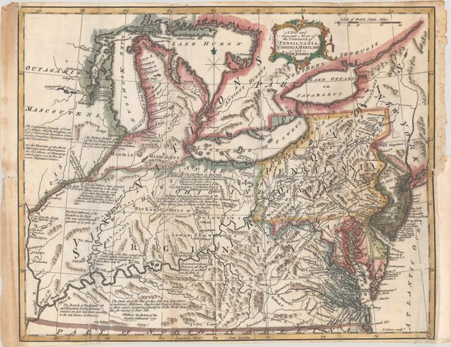
This uncommon map covers the region from Virginia and Kentucky north to the Great Lakes and west to the Mississippi River. Roads, rivers, mountains, lakes, towns, forts, Indian tribes, and other features are seen. There are numerous notations, many related to Indians, including "The Six Nations have extended their territories to the River Illinois ever since the year 1672" and "the Western Extent of the Territories of the Six Nations and Bounds of their Deed of Sale to the Crown of Great Britain…" Engraved by John Gibson and published in Andrew Millar’s American Gazetteer. An attractive post-French & Indian War map.
References: McCorkle (18th C. Geography Books) #7 [3]; Phillips (America) p. 674.
Condition: B
A sharp impression, issued folding and now flattened on a sheet with a medallion watermark, some extraneous creasing along the folds, and light soiling that is more prominent in the left margin. There are archival repairs to several small holes along the folds, a 3" binding tear at right, and a small hole in the Atlantic, with minor loss of image. Narrow margins at top and bottom.