Subject: France
Period: 1609 (circa)
Publication: Theatrum Orbis Terrarum
Color: Hand Color
Size:
18.9 x 15.7 inches
48 x 39.9 cm
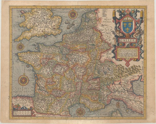
This superbly decorated map of France was created by Jan Baptista Vrients and was based on Petrus Plancius' map published in 1592. The map shows provinces, rivers, key cities, and illustrated mountains. It is adorned with five compass roses, sailing galleons, and a large title cartouche that features the French coat of arms. This map appeared only in later editions of the Theatrum Orbis Terrarum between 1606-41, and is therefore quite scarce. Latin text on verso, published in either 1609 or 1612.
References: Van den Broecke #36; Van der Krogt (Vol. III) #4000:31C.
Condition: B+
A nice example on paper with the horn coat of arms watermark commonly found on Ortelius maps. There is light soiling and archival repairs to a separation along the centerfold and a short tear at bottom.