Subject: California
Period: 1879 (dated)
Publication:
Color: Printed Color
Size:
32.9 x 37.5 inches
83.6 x 95.3 cm
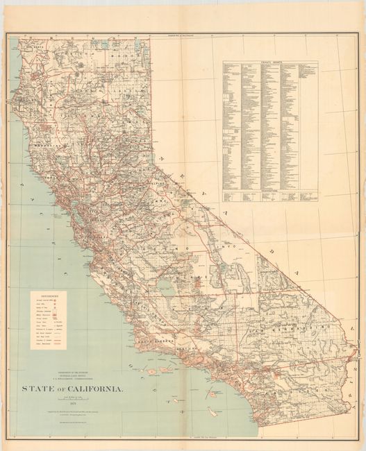
This separately issued large-scale map of California was printed on two sheets and joined. According to the David Rumsey Map Collection, it was "the first GLO map of California in printed colors" (see reference). Compiled by Charles Roeser, Principal Draughtsman, the map shows in great detail the extent of public surveys as well as hydrology and topography. It also delineates Indian reservations, military reservations, railroad limits, completed railroads, and private grants. At upper right a long list of 545 private grants are listed by name. A scarce item. Not listed in Kelsay's List of Cartographic Records of the General Land Office.
References: Rumsey #3456.
Condition: B+
There is a bit of light toning along the joint, minor foxing, and numerous small edge chips and tears along the sides of the sheet. A few of the edge tears at lower left just pass the neatline and have been closed on verso with archival tape.