Subject: Canada & Northern United States
Period: 1814 (dated)
Publication: A Modern Atlas
Color: Hand Color
Size:
27.1 x 19.6 inches
68.8 x 49.8 cm
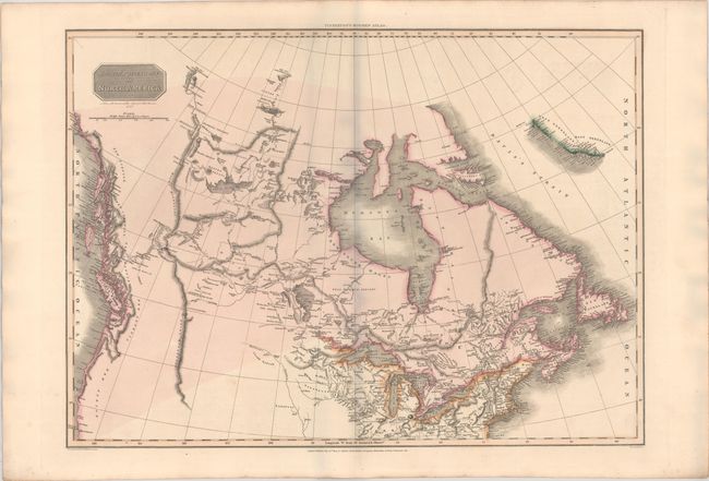
This handsome map is based on Arrowsmith's important map of North America. It presents the discoveries from Alexander Mackenzie's expedition of 1789, following the waterways from Slave Lake to the Arctic Ocean. The information from the recent Lewis & Clark expedition is not shown, leaving the interior Pacific Northwest rather blank. The Missouri River terminates in the lands of the Mandans and Snake Indians in present-day North Dakota. Hudson Bay and Strait are very carefully delineated with Repulse Bay, Wager River, and James Bay named. Published by Cadell & Davies Strand, & Longman, Hurst, Rees, & Orme.
References:
Condition: A
On sturdy paper with a "J. Whatman 1810" watermark and contemporary color. There is minor offsetting.