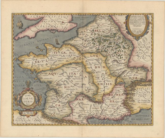
Subject: France
Period: 1603 (circa)
Publication: Theatrum Orbis Terrarum
Color: Hand Color
Size:
19.4 x 15.4 inches
49.3 x 39.1 cm
A lovely map of France during Roman times based on ancient geographical sources including Strabo, Plinius, Virgilius, Ovidius and Caesar. The map is filled with detail and ancient place names. Two ships sail in the stipple engraved oceans and the map is decorated with two fine cartouches. This is the second state with Marseille now appearing as Massilia rather than Marsilia and Sequani added northwest of the Jura mountain range. Latin text on verso, published in either 1603, 1609, or 1612.
References: Van den Broecke #196.
Condition: A
A fine impression on paper with the horn coat of arms watermark commonly found on Ortelius maps and minor marginal soiling.