Catalog Archive
Auction 179, Lot 449

"Carta del Oceano Atlantico Septentrional, con las Derrotas que Siguio Dn. Cristobal Colon...",

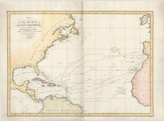
Subject: North Atlantic

Period: 1825 (dated)

Publication:

Color: Hand Color

Size:
25.3 x 18.3 inches
64.3 x 46.5 cm
Download High Resolution Image
(or just click on image to launch the Zoom viewer)

This uncommon Spanish map depicts Christopher Columbus' voyages of 1492, 1493, 1498 and 1502 to the New World. It covers the area from Spain and the west coast of Africa to the Caribbean and Gulf of Mexico. The map shows each voyage across the Atlantic and is keyed to the legend by line pattern and includes both directional arrows and daily progress. Drawn by M. Moreno.

References:

Condition: A

Issued folding on a clean sheet of watermarked paper. There is a tiny hole in a blank area at lower right.

Estimate: $275 - $350

Sold for: $200

Closed on 9/16/2020

Archived