Subject: Ostrov Vaygach Island, Russia
Period: 1600 (published)
Publication: Thresor de Chartes
Color: Hand Color
Size:
4.9 x 3.4 inches
12.4 x 8.6 cm
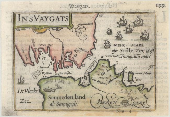
This is a miniature map of present day Ostrov Vaygach Island, located in the Barents Sea, depicting the narrow strait between the island and mainland Russia, here called "Samueden land". The sea is filled with sailing ships and the land is engraved with tiny hunting scenes. French text on verso.
The map was first published by Cornelius Claesz and printed by Barent Langenes in the 1598 edition of the popular Map Treasury. For the 1599 edition, graduation lines and latitude numerals were added to one side of the border on most of the maps, which were again used for multiple editions through 1650. This is from a French edition, printed by Albert Hendricks.
References: King (2nd ed.) pp. 80-82; Van der Krogt (Vol. III) #1274:341.
Condition: B+
A nice impression on a bright sheet with a light damp stain at bottom and a professionally repaired hole at bottom left, with a minor amount of neatline replaced in facsimile.