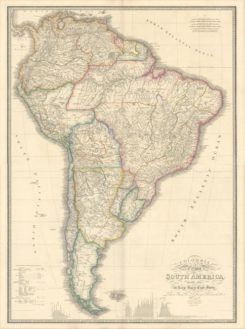
Subject: South America
Period: 1842 (circa)
Publication:
Color: Hand Color
Size:
30.5 x 21.1 inches
77.5 x 53.6 cm
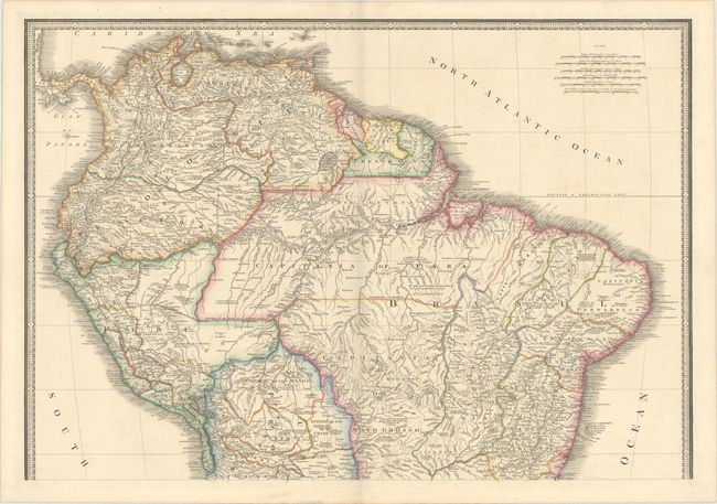
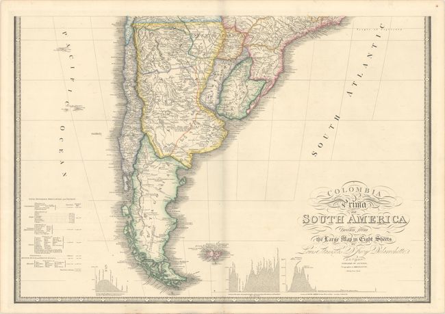
This striking large map is drawn from Louis Stanislas D'Arcy Delarochette's monumental eight-sheet map of South America, which was used to settle numerous border disputes throughout the continent. It incorporates the most up-to-date geographical information and includes numerous interesting notations throughout. Three insets in the lower portion of the map present data from Humboldt's report in the form of topographical profiles: "Section of the Andes…," "Section of South America from West to East…," and "Section of the Road from La Guayra to Caracas." It also includes a comparative distance table and an index titled "Civil Divisions, Population and Extent" for Colombia, Peru, the United Provinces, Chili, Patagonia, Brazil and Guyana. Printed on two sheets, unjoined, as issued - the map would measure 30.5 x 42.0" if joined.
References:
Condition: A
Contemporary color on sturdy paper with minor offsetting and faint scattered foxing. The first image is a composite image - the map is in two separate sheets.