Subject: Western Europe
Period: 1677 (dated)
Publication: Cartes de Geographie les plus Nouvelles…
Color: Hand Color
Size:
13.4 x 18.3 inches
34 x 46.5 cm
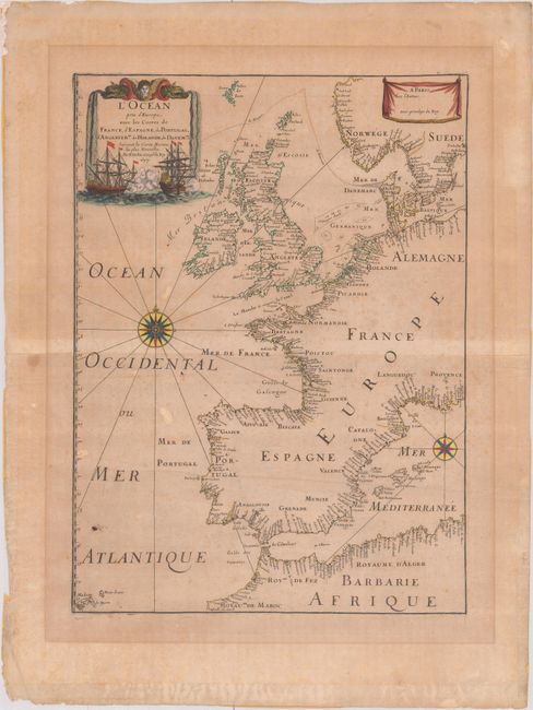
Very handsome chart by the famous 18th century cartographer, Pierre Du Val (1618-1683), showing the North Atlantic Ocean and the coast of western Europe from Scandinavia and Great Britain down to North Africa. The chart depicts all harbors around the coastlines with no inland detail. The chart includes a rare reference to the Kimmen Line, which indicates a depth of 100 fathoms from Denmark to just west of the Shetland Isles, north of Scotland. Two compass roses with radiating rhumb lines fill the ocean and the Mediterranean. The decorative title cartouche is ornamented with two fighting ships and is topped with a figurehead and scrolls.
References: Pastoureau, DUVAL II D.
Condition: B
Moderately toned paper with the watermark of the Royal French coat of arms, with light foxing, a hint of offsetting, and a couple of extraneous creases. There is masking tape along the edges of the sheet on verso, which could be trimmed while leaving ample margins.