Subject: Pacific Ocean, Atlas
Period: 1827 (published)
Publication:
Color: Hand Color
Size:
14.9 x 21.8 inches
37.8 x 55.4 cm
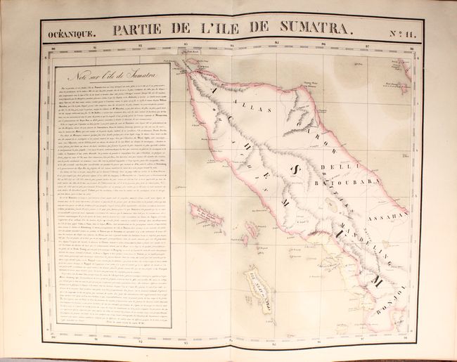
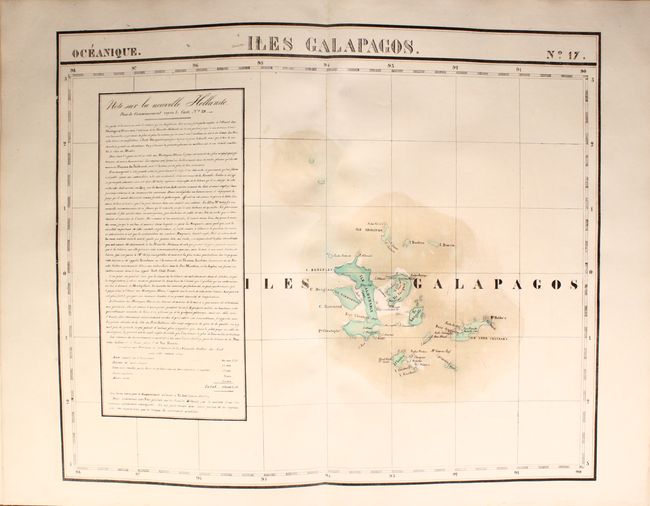
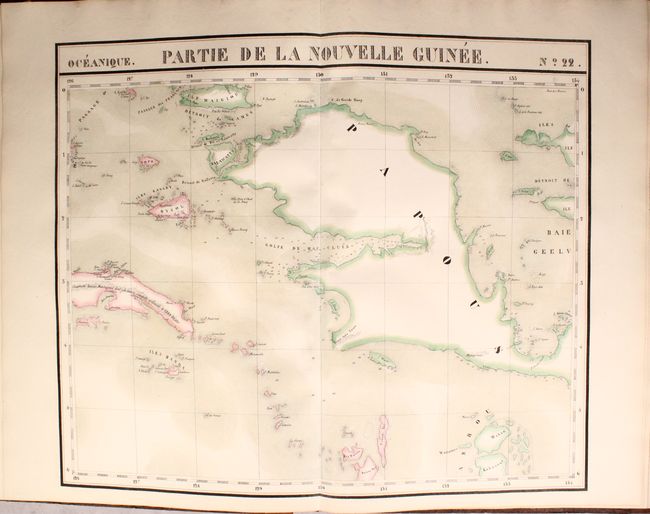
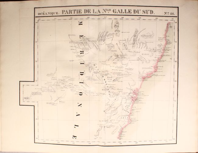
Vandermaelen was the son of a wealthy industrialist who abandoned his father's business to follow a career in cartography. His goal was to produce the first atlas ever published in which every map was drawn on the same projection and to the same scale (1: 1,641,836), with each map covering an area of approximately 20 degrees of longitude (from Paris) and 6 degrees of latitude. Because of the consistent scale and projection, the maps could be joined together to form a huge globe that would measure over 25 feet in diameter. Vandermaelen had the only known globe constructed from his maps, requiring a special room for its display. It was also the first lithographic atlas ever published. There was one edition of the atlas, published in 1825-27, and the subscription list shows that only 810 copies were sold. Koeman called his Atlas Universel, "One of the most remarkable world atlases ever made. Far ahead of its time."
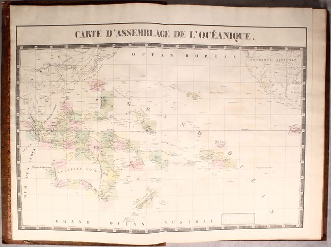
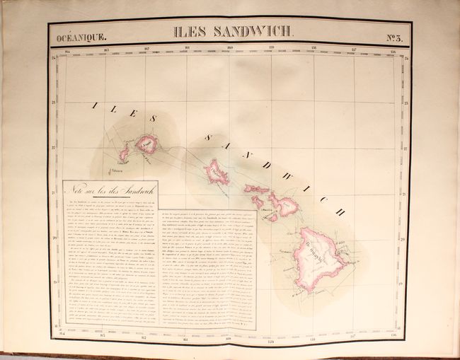
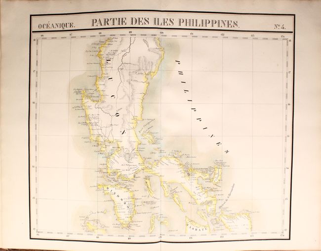
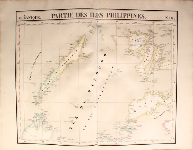
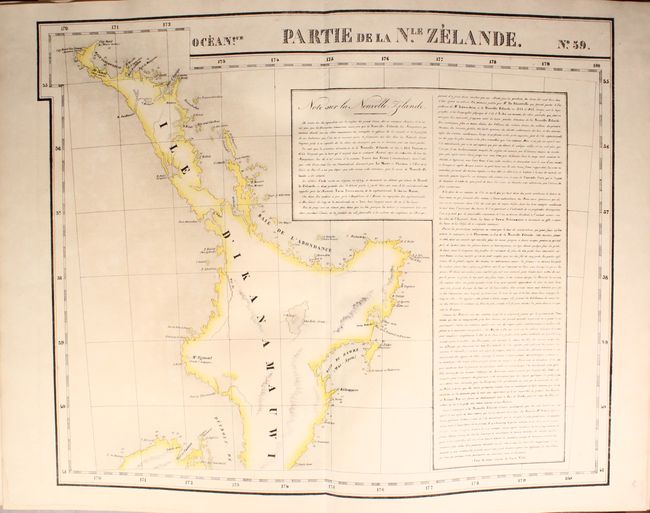
This attractive example of Vandermaelen's atlas of Oceania (volume 6 of 6) contains 60 (of 61) maps. Each beautifully hand-colored map (approximately 22 x 19") is drawn on the same scale, contains remarkable detail, and is surrounded by a bold block-style border. The index map, Carte D’Assemblage de L’Oceanique, shows the extent of each map within the Pacific region. The next maps, numbered No. 1 though 60, show Australia and Tasmania, New Zealand, the East Indies, the Philippines, Malaysia and all of the southern Pacific Islands including Hawaii. Map No. 12 is missing which, according to the index sheet, covers Singapore, the southern part of Malay peninsula and a small part of Sumatra.
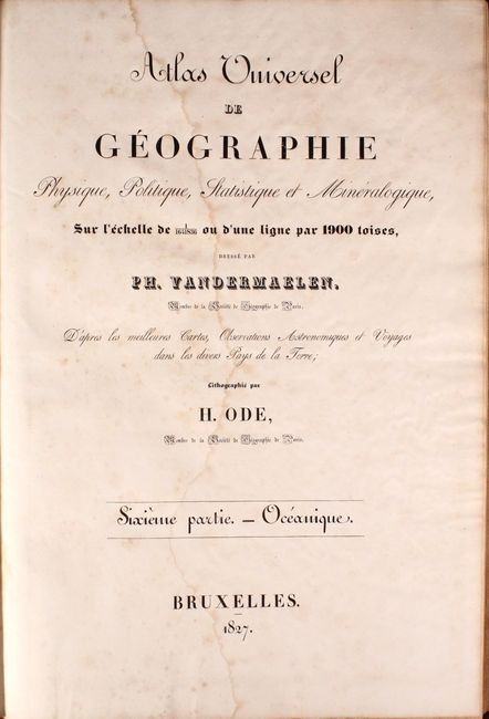
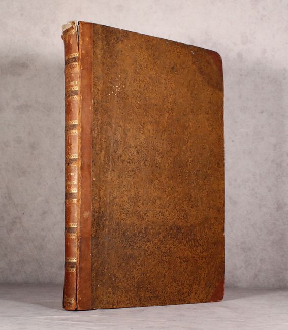
Bound in original brown speckled boards with quarter brown calf on spine and tips with gilt titling on spine. Finely marbled end papers and two title pages. The fine lithography was accomplished from Paris by H. Ode. A rare and remarkable atlas.
Philippe Vandermaelen was the son of a wealthy industrialist who abandoned his father's business to follow a career in cartography. His goal was to produce the first atlas ever published in which every map was drawn on the same projection and to the same scale (1: 1,641,836), with each map covering an area of approximately 20 degrees of longitude (from Paris) and 6 degrees of latitude. Because of the consistent scale and projection, the maps could be joined together to form a huge globe that would measure over 25 feet in diameter. Vandermaelen had the only known globe constructed from his maps, requiring a special room for its display. It was also the first lithographic atlas ever published. There was one edition of the atlas, published in 1825-27, and the subscription list shows that only 810 copies were sold. Koeman called his Atlas Universel, "One of the most remarkable world atlases ever made. Far ahead of its time."
References: Phillips (Atlases) #749; Tooley (Australia) pp. 159-60.
Condition: B+
The maps are generally very good to near fine with occasional light toning and offsetting. Map #27 (Java) is moderately foxed. The two title pages have light foxing and large water stains. Coves have light wear with bumped edges. There is some cracking along the joint at top and bottom as well as the spine, with the upper 0.5" missing.