Subject: Northern France
Period: 1634 (circa)
Publication: Novus Atlas
Color: Hand Color
Size:
20.7 x 15.1 inches
52.6 x 38.4 cm
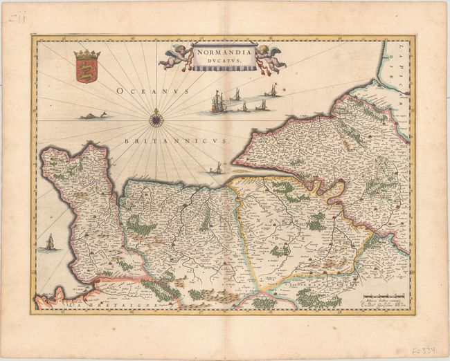
This very detailed map of the Normandy coast extends from Cherbourg and Avranches in the west to Dieppe and Rouen in the east. The map also features Caen, Le Havre, and Mont Saint Michel in the lower left corner. A compass rose, ships, fishing boats, and a sea monster are depicted in the English Channel. The map is adorned with a large title cartouche flanked by putti and Normandy's coat of arms. German text on verso, published between 1634-35.
References: Van der Krogt (Vol. II) #4400:2.
Condition: B+
A crisp, early impression with faint offsetting, light toning along the centerfold, and a few small spots.