Catalog Archive
Auction 174, Lot 214

"Hawaii. The Outline from Vancouver; Improved by the Deputation [with related text]",

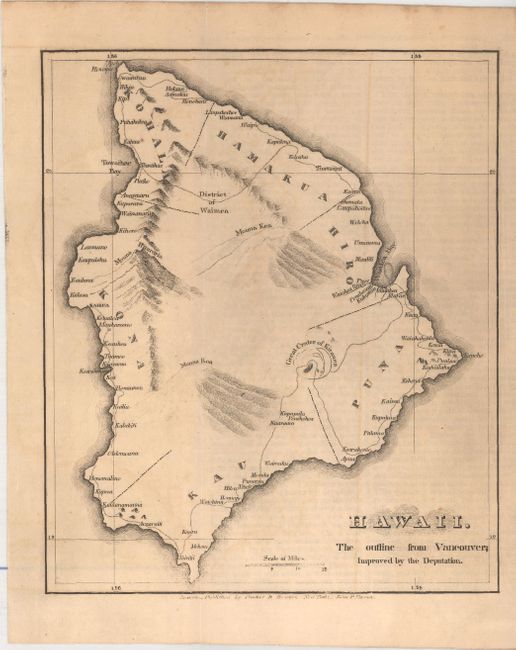
Subject: Big Island, Hawaii

Period: 1826 (dated)

Publication:

Color: Black & White

Size:
6.1 x 7.3 inches
15.5 x 18.5 cm
Download High Resolution Image
(or just click on image to launch the Zoom viewer)

A basic map that shows six political districts along the coastline including Puna, Hiro, Hamakua, Kohal, Kona, and Kau. It shows what appears to be a road mostly confined to the shoreline with named villages scattered along it. Mona Kea and Mona Roa are noted as is the "Great Crater of Kirauea." The publisher’s imprint of Crocker & Brewster is in the bottom blank margin. Includes 10 pages of related text (pp. 141-150) from The Missionary Herald. For the Year 1826 that describes the work happening on the Hawaiian islands.

References: Fitzpatrick #49.

Condition: B+

The map is lightly toned with a bit of faint offsetting. Disbound text is also lightly toned.

Estimate: $160 - $190

Unsold

Closed on 9/11/2019

Archived