Subject: Northwestern United States, Indian Wars
Period: 1889 (circa)
Publication:
Color: Printed Color
Size:
23.4 x 21.9 inches
59.4 x 55.6 cm
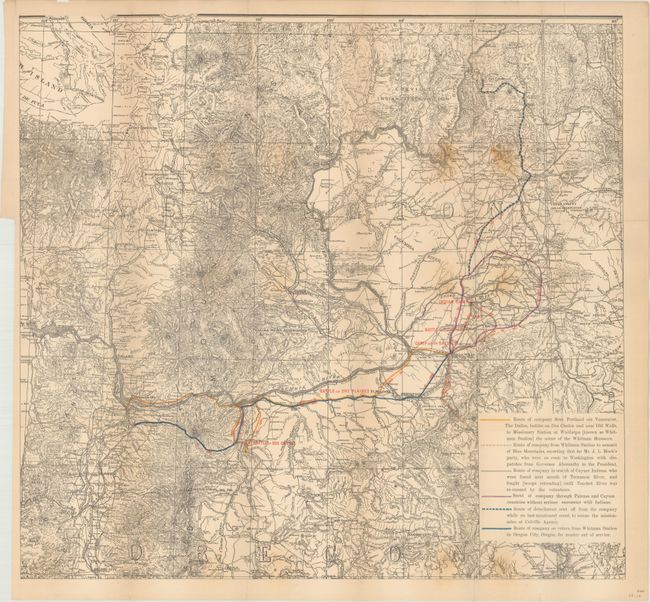
This map covers portions of Oregon and Washington along the Columbia River and shows the routes of Captain Hall's Company of Oregon Volunteers who fought during the Cayuse War, the first of the Indian Wars in the Pacific Northwest. The war was instigated by the slaughter of 14 missionaries at Whitman Mission near Walla Walla, and lasted for nearly eight years until the Cayuse Indians were eventually defeated. The map was issued in a government report more than 40 years after the war ended. It is credited to Colonel Thomas R. Cornelius, a pioneer who served extensively in the Indian Wars and for whom Oregon is named.
References:
Condition: B
Issued folding with light toning along the fold lines, minor staining at right, and a number of fold separations along the right two vertical folds that have been closed on verso with archival tape.