Subject: World
Period: 1782 (circa)
Publication:
Color: Hand Color
Size:
16.8 x 12.7 inches
42.7 x 32.3 cm
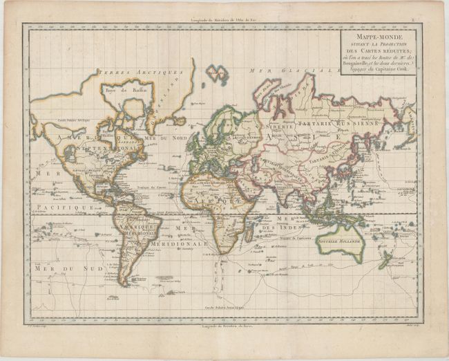
Very finely engraved world map drawn on Mercator's Projection. The map features the explorations of Bougainville and Cook with the routes delineated and dated. There is interesting cartography in the northwest of North America, with a large Sea of the West that connects to several systems of rivers and lakes to the east. In northwestern Canada is another large, unnamed inland lake with two rivers connecting it to the Pacific Ocean. The northern regions of Canada and Greenland are left open-ended, with Greenland connected to the mainland. Antarctica is virtually empty with only a few glaciers noted and Sandwick and Port de Drak identified. In the South Pacific, New Zealand is well defined but Tasmania is still connected to Australia. Engraved by Pierre Francois Tardieu and Andre. This is the first state, with plate number 2 at top right.
References: McGuirk #185.
Condition: B+
A crisp impression on watermarked paper with very light soiling and minor toning along the edges of the sheet.