Subject: Cartographic Miscellany, World War II, Pacific Ocean
Period: 1945 (dated)
Publication:
Color: Printed Color
Size:
32.3 x 31.6 inches
82 x 80.3 cm
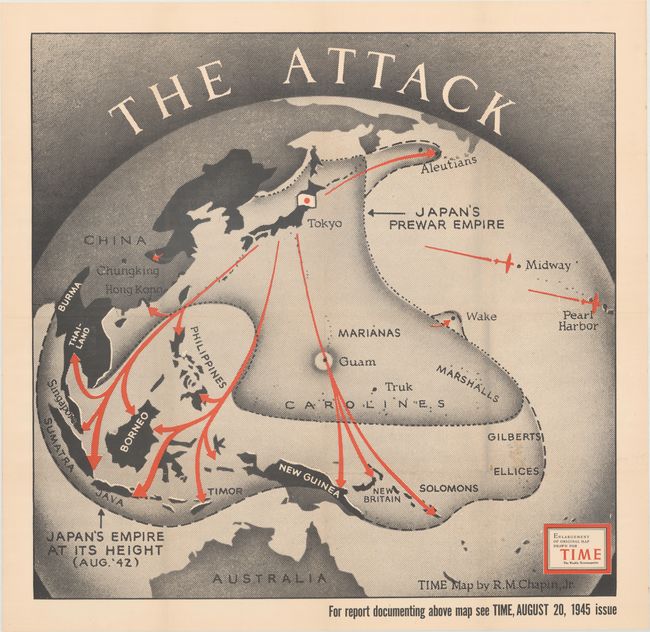
This fascinating map is an enlarged version of one by Robert Chapin that was included in the August 20, 1945 issue of Time Magazine. Drawn on a stereographic projection (as if viewing the region from space), it presents Japan's pre-war empire extending to Hong Kong, Thailand, and the Carolines. Bold red arrows show "the attack" which pushed Japan's empire farther south to include the East Indies and portions of New Guinea. Additional offensives to Midway, Pearl Harbor, and the Aleutian Islands are illustrated.
Robert M. Chapin began working for Time magazine in 1937 after a short stint as a photo retoucher at Newsweek. During World War II, his prolific team produced about a map every day to keep up with the breaking war news. Chapin would spend a total of 33 years with the company and retired as the cartography head of the magazine.
References:
Condition: A
Issued folding with a faint spot at lower right, otherwise fine.