Catalog Archive
Auction 172, Lot 362

"Le Chili et les Provinces qui Composent Celle de Rio de la Plata avec les Terres Magellanique", Fer, Nicolas de
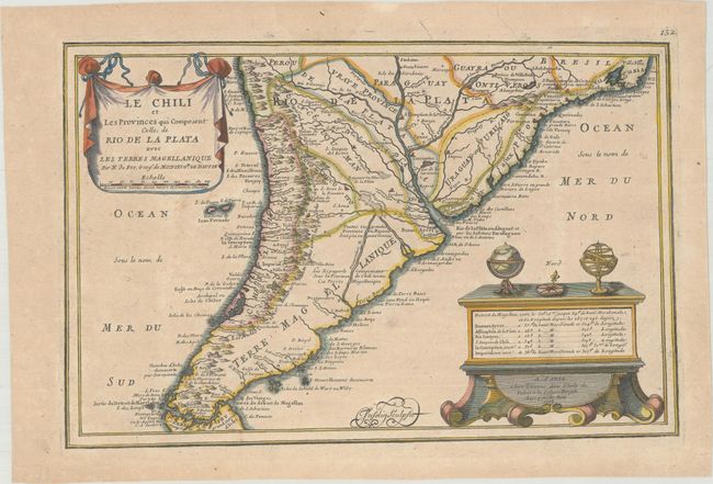
Subject: Southern South America

Period: 1705 (dated)

Publication: L'Atlas Curieux ou le Monde

Color: Hand Color

Size:
13.3 x 8.6 inches
33.8 x 21.8 cm
Download High Resolution Image
(or just click on image to launch the Zoom viewer)

This map shows detail mostly confined along the coastlines, but there are some inland features including rivers, lakes, marshes and the locations of missions. The Andes are noted as a vast volcanic cordillera. A table of longitudes and latitudes of key cities and the publisher's imprint are presented on a large chest, which is also supporting a globe, compass and armillary sphere. Finely engraved by Charles Inselin.

References: Pastoureau, FER I [114].

Condition: B+

Light toning and minor soiling with a short printer's crease at top right.

Estimate: $180 - $210

Sold for: $90

Closed on 4/17/2019

Archived