Catalog Archive
Auction 172, Lot 362
"Le Chili et les Provinces qui Composent Celle de Rio de la Plata avec les Terres Magellanique", Fer, Nicolas de
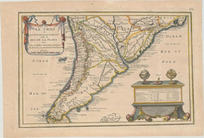
Subject: Southern South America
Period: 1705 (dated)
Publication: L'Atlas Curieux ou le Monde
Color: Hand Color
Size:
13.3 x 8.6 inches
33.8 x 21.8 cm
Download High Resolution Image
(or just click on image to launch the Zoom viewer)
(or just click on image to launch the Zoom viewer)