Subject: East Indies - Indonesia
Period: 1753 (dated)
Publication: Nieuwe en Beknopte Hand Atlas
Color: Hand Color
Size:
14.3 x 12.6 inches
36.3 x 32 cm
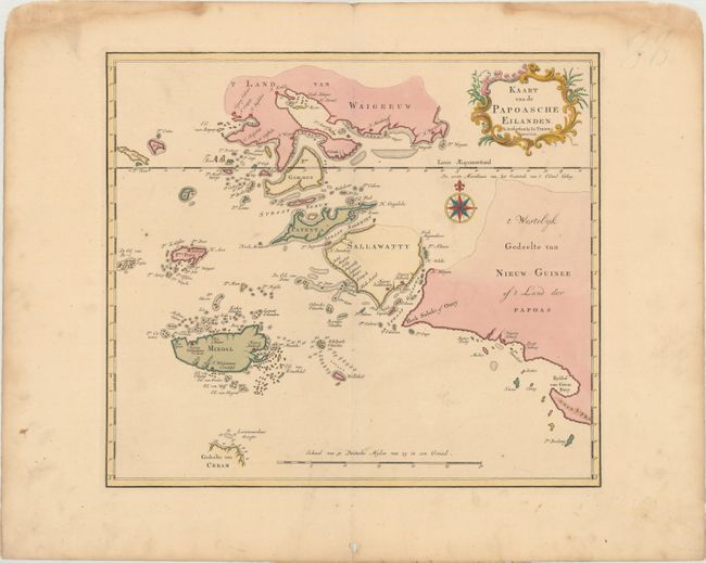
This beautifully engraved chart spans from the Spice Islands (Sallawatty, Patenta, Gammen, Land van Waigeeuw, Popo, Misool, and part of Seram) to the western end of Papua New Guinea. Many smaller islands are detailed, and depth soundings are shown near Seram and to the east of Misool. Some of the islands are depicted with some indistinct coastlines. The chart is embellished with a fine compass rose and decorative title cartouche.
References:
Condition: A
In original color on a sheet with a large fleur-de-lis coat of arms watermarked, marginal soiling, and three small holes, one in the title cartouche and the other two in the bottom blank margin. There are damp stains in the top blank margin, well away from the image.