Subject: Virginia & West Virginia
Period: 1814 (circa)
Publication: American Pocket Atlas
Color: Black & White
Size:
7.6 x 5.7 inches
19.3 x 14.5 cm
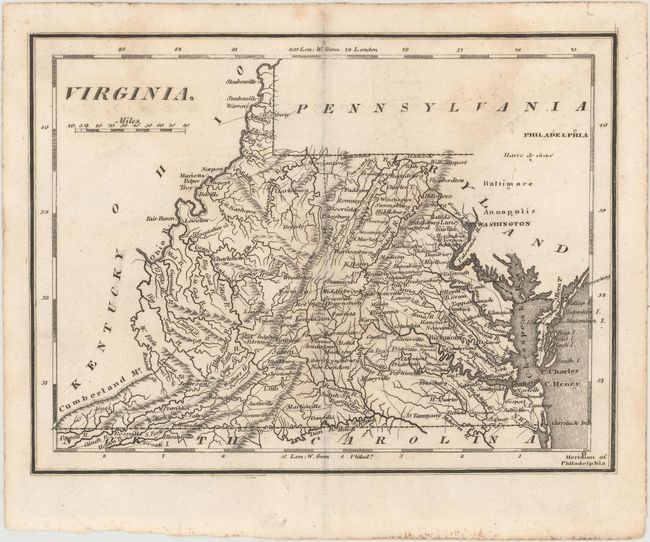
Mathew Carey was a seminal figure in early American publishing; establishing the first publishing firm to specialize in cartography and issuing the first atlas devoted exclusively to American maps. He set up an elaborate cottage system of craftsmen for compiling, engraving, printing, and coloring maps. This practice was emulated by later American cartographic publishers such as John Melish and Henry S. Tanner. The American Atlas concept was also adopted by other publishers in both the United States and Europe.
This is a later edition of this map first published in 1796. The first edition was copied from Scott's map of the state, again showing the western boundary on the western fork of the Big Sandy River rather than the eastern fork. It features fine topographical detail and names several towns and cities, including Washington (not yet the District of Columbia), Richmond, and Charlotteville. In this edition, Northwest Territory has been replaced by Ohio. No engraver signature is present on this edition. Accompanied by 8 pages of related text from Carey's American Pocket Atlas.
References: cf. Wheat & Brun #570; cf. Wooldridge #178.
Condition: B+
A dark impression with some light staining at top. Accompanying text is lightly toned.