Subject: Oklahoma
Period: 1902 (dated)
Publication: Tenth Annual Report of the Commission to the Five Civilized Tribes
Color: Printed Color
Size:
24.5 x 26.2 inches
62.2 x 66.5 cm
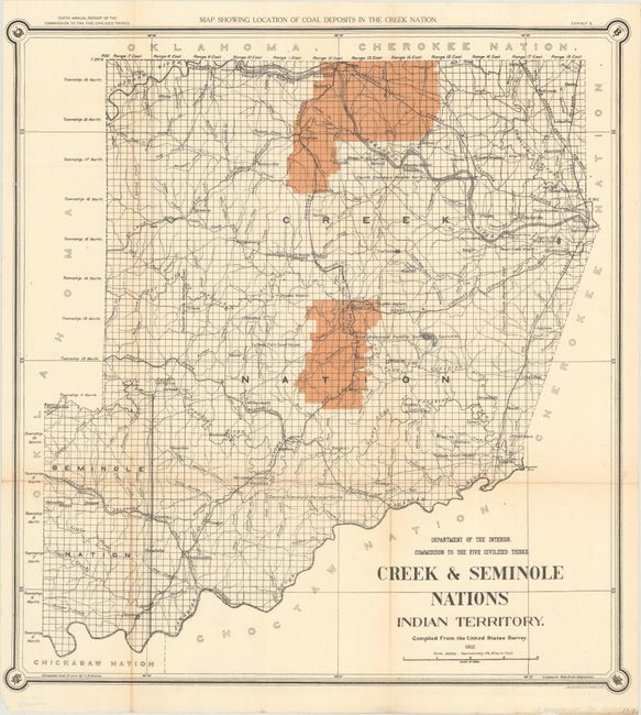
The Commission to the Five Civilized Tribes was appointed to negotiate with the Five Tribes for the extinguishment of their tribal title to lands by allotment, and division of the same among the members of the tribes. This commission became known as the Dawes Commission, after Senator Henry L. Dawes, who was largely responsible for the legislation. Their main task was to make an equitable division of nearly twenty million acres of land among more that 100,000 Indians. In 1895 the USGS began to conduct surveys of all lands in Indian Territory into townships, ranges and sections. These maps were used by the Dawes Commission to assist the citizens on the tribal rolls to select their individual plats of land. Complied and drawn by C.H. Dana, it uses color block to show the "Location of Coal Deposits in the Creek Nation." It also shows watershed, townships, rail roads, wagon roads, missions, "orphan asylums," and court houses. The territory is bounded shown is bounded by Oklahoma in the west, Choctaw Nation in the south, and the Cherokee Nation in the east. The few high areas are indicated by hachure. Issued folding, now backed with archival tissue. No flaws except for light toning on two folds. (B+)
References:
Condition: B+
Issued folding, now backed with archival tissue. There is light toning along some of the folds and a couple tiny splits at fold intersections.