Subject: Florida & Cuba
Period: 1700 (circa)
Publication:
Color: Hand Color
Size:
23.2 x 19.9 inches
58.9 x 50.5 cm
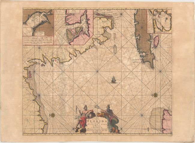
This uncommon chart is believed to be the first sea chart of the eastern portion of the Gulf of Mexico, and shows Florida's gulf coast from Pensacola to Cape Florida, with the western part of Cuba. The cartography is based in part on Hessel Gerritsz' chart circa 1631, and nearly all the place names on the chart are Spanish. The chart is oriented with north to the left, with a bit of the Yucatan Peninsula shown at lower right. Three insets depict the Cuban harbors: Matanzas Bay, Havana Harbor and Hondo Bay. The elaborate cartouche is flanked by Neptune, god of the sea, and one of the wind gods. This is the third state, with the plate number "15" added at bottom right and left, and a shoal added off the Yucatan peninsula.
References: Burden #591; Martin & Martin, p. 84-85.
Condition: B
A dark impression with full, contemporary color on a sturdy, double-thick sheet with moderate toning and foxing and a short tear in the right blank margin. There are short centerfold separations at top and bottom that have been repaired with archival tape on verso.