Catalog Archive
Auction 171, Lot 227

"Yosemite National Park Showing Boundaries Established by Act of Congress Approved June 11, 1906", U.S. Government

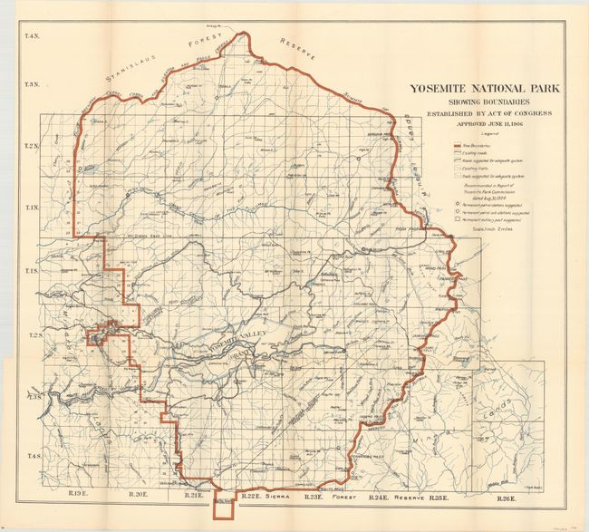
Subject: Yosemite, California

Period: 1906 (dated)

Publication:

Color: Printed Color

Size:
27.1 x 24.7 inches
68.8 x 62.7 cm
Download High Resolution Image
(or just click on image to launch the Zoom viewer)

This colorful map illustrates the new boundaries of Yosemite National Park with the incorporation of the Yosemite Grant near the middle of the park and the Big Tree Grant at bottom. It contains considerable detail on a scale of 2 miles to the inch. A legend provides an explanation of symbols including existing and suggested trails, roads, and patrol stations.

References:

Condition: B+

Issued folding with a hint of toning along the fold lines and a few tiny splits at fold intersections. There is a binding trim at left, but still adequate margin for framing.

Estimate: $100 - $130

Sold for: $75

Closed on 2/6/2019

Archived