Subject: North America, Texas
Period: 1844 (dated)
Publication:
Color: Hand Color
Size:
11.3 x 16.9 inches
28.7 x 42.9 cm
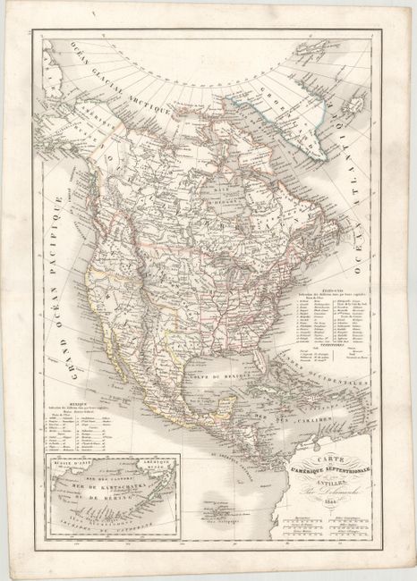
The Republic of Texas was a sovereign state in North America from 1836 to 1845. It was formed as a break-away republic from Mexico by the Texas Revolution. The nation claimed a large region that included all of the present state of Texas together with part of the former Mexican region of New Mexico (parts of present-day New Mexico, Oklahoma, Kansas, Colorado, and Wyoming). The eastern boundary with the United States was defined by the Adams-Onís Treaty between the United States and Spain, in 1819. Its southern and western-most boundary with Mexico was under dispute throughout the existence of the republic, with Texas claiming that the boundary was the Rio Grande, and Mexico claiming the Nueces River as the boundary.
Uncommon edition of this map of the continent with the Independent Republic of Texas and early western territorial borders in the United States. The District Oregon ou Colombie extends into present-day British Columbia and is bounded by the Rocky Mountains. Missouri Territory takes in the entire region between Oregon and the Mississippi except for the young states of Missouri, Arkansas, and Louisiana. The map is filled with the locations of many Indian Districts and Tribes. The Aleutian Islands are shown in an inset on the same scale as the main map. A table at right lists 26 states and the territories of the United States, and another table lists 20 states for Mexico.
References:
Condition: A
Original outline color with light printer's ink residue primarily in the blank margins.