Subject: North America
Period: 1812 (dated)
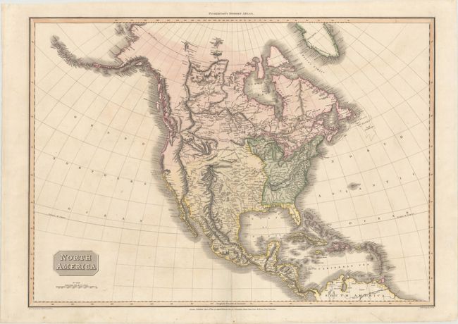
Publication: Pinkerton's Modern Atlas
Color: Hand Color
Size:
27.7 x 19.7 inches
70.4 x 50 cm
This great early nineteenth-century map is based on Arrowsmith's seminal map. It is one of the first atlas maps to show the discoveries of Lewis and Clark. A note reads "Course of the Missouri according to Capt. Lewis," with its tributaries labeled R. Jefferson, Madison R., and Gallatin R. Pinkerton also includes a variety of information about the various Native American tribes and nations throughout the west. Published in London during the War of 1812, the map sleights Americans by delineating the Mississippi River as the western boundary of the United States, nine years after the Louisiana Purchase expanded the young nation's frontier.
References: Wheat (TMW) #311.
Condition: B+
Original color. There is minor offsetting and a 9" centerfold separation at bottom that has been repaired on verso with archival materials.