Subject: North Atlantic
Period: 1740 (dated)
Publication: Gentleman's Magazine
Color: Hand Color
Size:
11.6 x 13.8 inches
29.5 x 35.1 cm
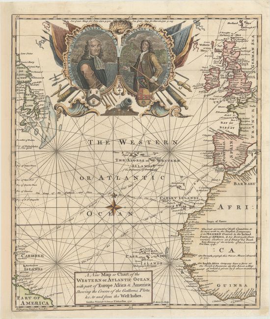
This handsome map of the Atlantic illustrates the commercial rivalry between Britain and Spain with the major shipping routes traced. It includes small parts of South America, the Caribbee Islands, Newfoundland and Labrador, western Africa and Europe. The chart is covered with interesting notations concerning the history of the region, territorial claims, and the tracks of the Spanish treasure fleets. A large military-style cartouche features the portraits of Admiral Blake (1650) and Vice Admiral Vernon (1740); two immensely popular British admirals in the ongoing fight against Spain. This map was published at the beginning of the War of Jenkin's Ear in which Vice Admiral Vernon captured the Spanish possession of Porto Bello. Ironically, less than a year later his next campaign against the Spanish at Cartagena ended in disaster, virtually ending his illustrious naval career.
References: Jolly #GENT-14.
Condition: B+
Issued folding on watermarked paper with a binding trim at bottom right replaced with old paper and an associated 5" binding tear that has been professionally repaired on verso. Remargined at left with a tiny portion of the border redrawn in facsimile.