Subject: Texas
Period: 1871 (published)
Publication: Atlas of the State of Illinois...
Color: Hand Color
Size:
17 x 13.9 inches
43.2 x 35.3 cm
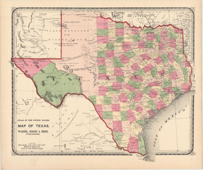
This uncommon map of Texas was issued in an Atlas of the State of Illinois To Which Is Added An Atlas Of The United States... by Warner, Higgins & Beers in Chicago. The map presents good detail throughout the settled part of the state, with county configurations current to 1865 (prior to the creation of Hood County from Johnson in 1866). The western third is comprised of the large unsettled areas of Presidio, El Paso, and unnamed Bexar and Young territories. The evolving railroad network is well represented and both the Proposed Southern Pacific Railroad and the U.S. Mail Route are noted. Surrounded by a decorative border.
References: Phillips (Atlases) #1512; Rumsey #3749.
Condition: A
A nice example with just a hint of toning along the sheet edges.