Subject: Grand Canyon, Arizona
Period: 1882 (published)
Publication:
Color: Printed Color
Size:
30.6 x 17.1 inches
77.7 x 43.4 cm
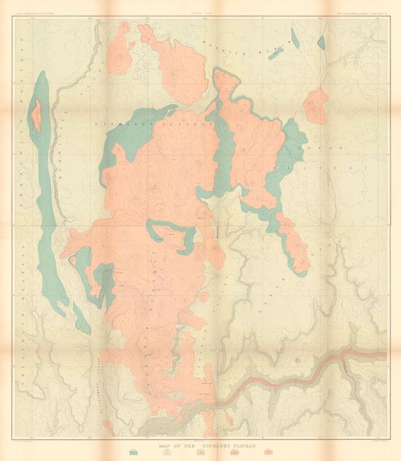
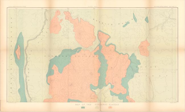
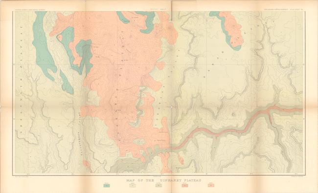
This map, printed on two sheets, was issued in the quarto edition of Clarence Dutton's Atlas to Accompany the Monograph on the Tertiary History of the Grand Canon District - one of the most important works on the region ever produced. It is centered on the Uinkaret Plateau, a large volcanic field situated on the north rim of the Grand Canyon. Located within this plateau are Mt. Trumbell, Vulcan's Throne, and Witch's Pool to name a few. The map extends to include portions of the Sheavwits Plateau and the Kanab Plateau with a key identifying 5 different geological types.
References:
Condition: B
Issued folding with several short fold separations that have been repaired on verso with archival tape. There is light toning along the fold lines and a tiny amount of loss at two fold intersections. The first image is a composite image - this map is in 2 separate sheets.