Subject: Mid-Atlantic United States
Period: 1825 (dated)
Publication:
Color: Hand Color
Size:
21.8 x 17.2 inches
55.4 x 43.7 cm
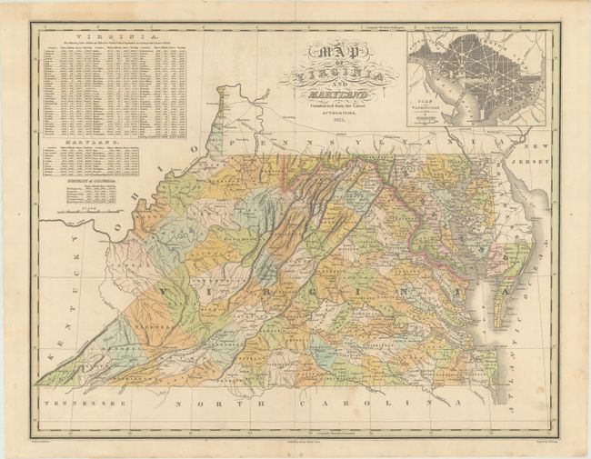
Finely's maps employ a delicate and elegant engraving style and provided extensive topographical and watershed information. He was the dominant map maker in the United States in the early 1820s into the 1830s. His atlases were very successful, outselling rival atlases by Carey & Lea, and Tanner. His maps were printed on high quality paper and were routinely corrected and updated.
This detailed map depicts counties, county seats, roads, and rivers through present-day Virginia, West Virginia, and Maryland. County configuration is current to 1823 with Alleghany County appearing (1822), but prior to the creation of Logan County (1824). At top left are tables showing the 1820 census of white, free black, and slave populations by county in Virginia, Maryland, and the District of Columbia. At top right is a bird's-eye plan of Washington D.C. and Georgetown. Drawn by D.H. Vance and engraved by J.H. Young.
References:
Condition: B+
A nice impression with faint offsetting and minor staining. There is a short centerfold separation at top and a 3.5" separation at bottom that have both been closed on verso with archival tissue.