Catalog Archive
Auction 169, Lot 506

"Royaumes d'Espagne et de Portugal", Robert de Vaugondy, Gilles

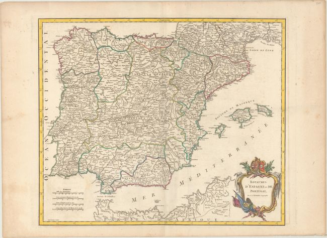
Subject: Spain & Portugal

Period: 1752 (circa)

Publication: Atlas Universel

Color: Hand Color

Size:
22.9 x 19.1 inches
58.2 x 48.5 cm
Download High Resolution Image
(or just click on image to launch the Zoom viewer)

This detailed map of Spain and Portugal extends to show the Languedoc region of France and the Barbary Coast of northern Africa. There is good detail of the Balearic Islands with numerous place names. States are colored in outline. The decorative cartouche features a coat-of-arms and flags in a fancy frame. Engraved by Guillaume Delahaye.

References: cf. Pedley #301.

Condition: B+

A crisp impression on a watermarked sheet with light offsetting and minor scattered foxing. There is an extraneous horizontal crease near the middle of the image.

Estimate: $200 - $230

Sold for: $120

Closed on 9/12/2018

Archived