Subject: London, England
Period: 1837 (dated)
Publication:
Color: Hand Color
Size:
35.3 x 34.5 inches
89.7 x 87.6 cm
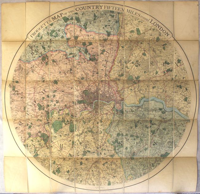
This large, circular map of London and vicinity extends from Uxbridge east to Greenhithe and from Broxbourne south to Caterham. The street-grid pattern of the city is depicted at the center of the image, with concentric circles showing distances of 3, 12, and 15 miles from city center. The map contains a remarkable amount of detail including major streets, bridges, parks, prominent features, adjoining towns and villages with connecting roads, and more. This edition, published by W. New at No. 11 Strand, is not listed in Howgego, however, a later edition by Cruchley was published circa 1842 (see reference). The map has been dissected into 40 panels and backed with original linen. It folds into a green, blindstamped slipcase with orange paper label (5 x 7.5"). Price marked 15 shillings.
References: cf. Howgego #382.
Condition: B+
A nice example with one small abrasion in Kent (just north of Bromley) and overall light toning. There is minor soiling, faint offsetting of the circular border, and a few extraneous creases, all of which is confined to the blank margins. Slip case has light wear with bumped edges and a few small chips to the paper title label.