Subject: Holy Land
Period: 1572 (circa)
Publication: Liber Chanaan...
Color: Black & White
Size:
19.7 x 13.3 inches
50 x 33.8 cm
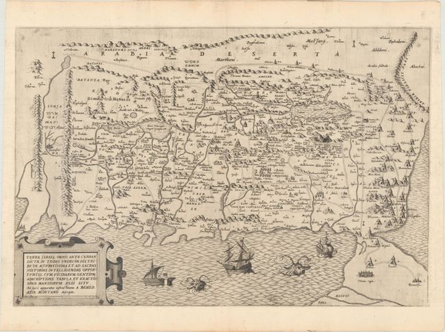
Uncommon and handsome map of the Holy Land, oriented with east at the top. The map shows the divisions of the eleven tribes as well as 43 Israelite desert encampments represented by tents. The western shoreline goes from Beirut in the north to the Nile Delta in the south. The Kishon River, here called Chedumin flu, connects Haifa Bay and Tiberius Lake (the Sea of Galilee). Five cities appear in the Dead Sea; Sodoma, Gomora, Adamo, Seboim and Segor. There are many place names and cities shown, some in Hebrew. The map is adorned with lovely ships and really adorable sea monsters. Engraved by Pieter van der Heyden.
References: Laor #46.
Condition: A+
A lovely, dark impression on a clean, bright sheet of watermarked paper with a hint of toning along the edges of the sheet.