Subject: Central United States
Period: 1837 (dated)
Publication: Sen. Doc. 65, 25th Congress, 2nd Session
Color: Hand Color
Size:
15.5 x 21.7 inches
39.4 x 55.1 cm
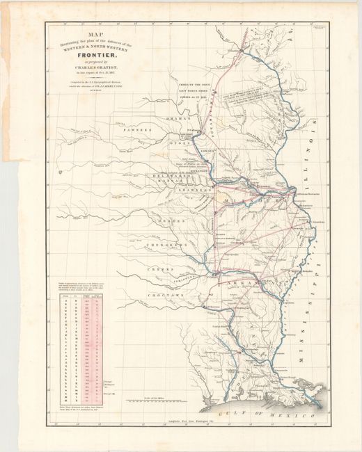
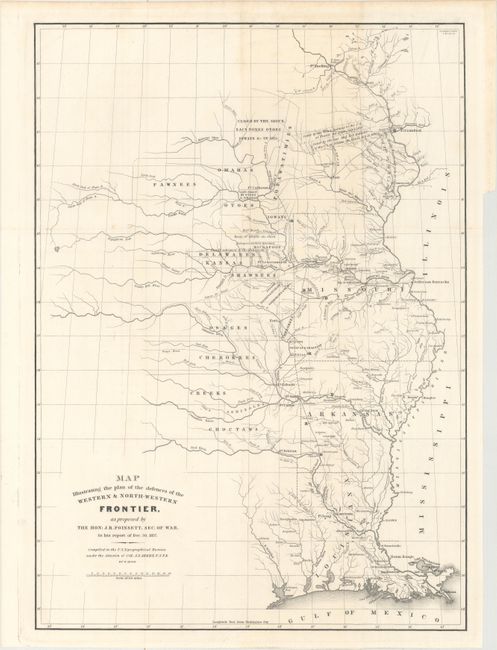
These two maps depict the Congressional debate over the nature of the Frontier Defenses between the Mississippi River and the Rocky Mountains, illustrating the proposals of J.R. Poinsett and Charles Gratiot. Both maps depict the states of Missouri, Arkansas, Louisiana, and Indian nations bordering them to the west. Military forts and outposts from Ft. Jessup to Ft. Snelling are designated, and notations identify the lands ceded by several Indian nations with dates of the treaties. The threat posed by hostile Indians, whose numbers greatly exceeded those of the settlers in the area, resulted in a protracted Congressional debate concerning the defenses required along the frontier. Poinsett's plan is the least detailed. Gratiot’s plan uses color to trace the common roads and rivers and adds a table showing distances between forts and "days of march" at 15 miles per day.
References: Wheat (TMW) #426 & #427; Clausen & Friis #182 & #183.
Condition: B+
Both sheets are issued folding. The Gratiot has light scattered foxing and the Poinsett has minor toning and a few spots of foxing.