Subject: World
Period: 1732 (circa)
Publication: Atlas Minor
Color: Hand Color
Size:
10.4 x 7.9 inches
26.4 x 20.1 cm
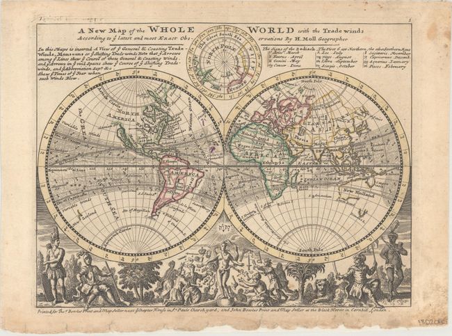
Very nice map with California as an Island. Northwestern North America is largely left blank, with Annian Str. appearing north of California. The eastern seaboard is labeled as the English Empire. Northeast Asia is only partially delineated, with a note in northern Russia that reads, "Parts Unknown." The borders of Australia and Tasmania are incomplete. Above the hemispheres is a north polar projection. The bottom is filled with unusual male representations of the continents and other interesting allegorical scenes. This early thematic map uses arrows to depict the trade winds and their directions. A note at top discusses trade winds and monsoons and incorporates a list of the zodiac signs. Imprint below bottom neatline notes that the map was printed for Thos. Bowles Print and Map Seller next ye Chapter House in St. Pauls Churchyard, and John Bowles Print and Map Seller at the Black Horse in Cornhill, London.
References: Shirley (BL Atlases) T.MOLL-9b #1; Phillips (Atlases) #585-1.
Condition: B+
Light soiling with minor edge chips and short tears confined to the bottom blank margin, which has been reinforced on verso with tissue. There are two, tiny extraneous purple ink marks at the center of the map image.