Subject: Exploration & Surveys, China
Period: 1804 (published)
Publication:
Color: Black & White
Size:
8.5 x 11.4 inches
21.6 x 29 cm
This is the rare atlas volume of the third French edition of George Staunton's account of George Macartney's travels to China. Macartney was Britain's first envoy to China, and was tasked by King George III with convincing Emperor Qianlong to ease restrictions on trade between Great Britain and China by allowing the British to have a permanent embassy in the country. This volume includes three large folding maps and 38 plates, all of which were engraved by Tardieu. The maps were drawn from information supplied by John Barrow, who was the private secretary to Lord Macartney. Barrow was later Secretary to the Admiralty and was a vice-president and founding member of the Royal Geographical Society. The maps are:
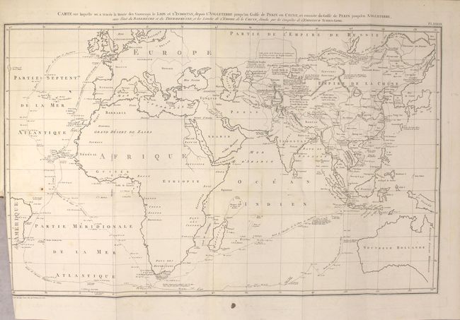
A. Carte sur Laquelle on a Tracee la Route des Vaisseauz le Lion et l'Indostan, Depuis l"angleterre jusqu'au Golfe de Pekin en Chine... This map of the eastern hemisphere shows the route of Macartney's ships from Britain to China with a solid line, and the return trip home with a dashed line. While Europe, Africa and Australia are largely devoid of cartographic information, there is good detail of rivers, place names, mountains and notations in China and northern Asia.
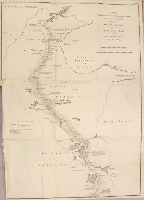
B. Carte sur Laquelle Est Tracee la Route qu'a Suivie l"ambassade Anglaise, depuis Zhe-Hol en Tartarie jusqu'a Pekin, et de Pekin a Hang-Tchou-Fou, en Chine. This map shows Macartney's route from just north of the Great Wall of China to Hangzhou, just south of present-day Shanghai. The route followed the Grand Canal, the longest ancient canal in the world, from Hangzhou to Beijing. The official courier stations, each placed at intervals of 35 to 45 km, are noted along the route.
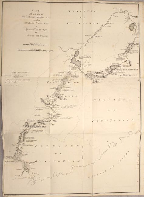
C. Carte de la Route que l'Ambassade Anglaise a Suivie en Allant de Hang-Tchou-Fou a Quang-Tchou-Fou ou Canton en Chine. This map shows the remainder of Macartney's route from Hangzhou to Canton.
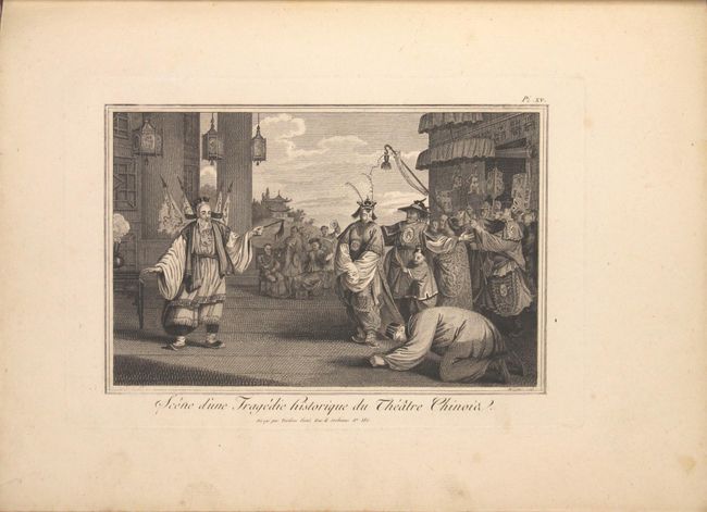
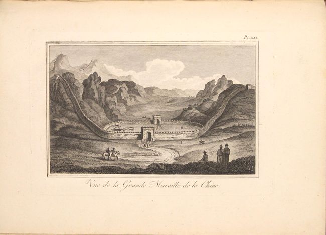
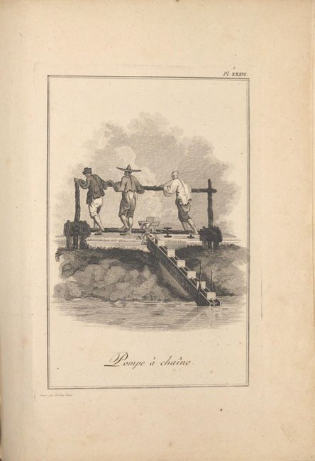
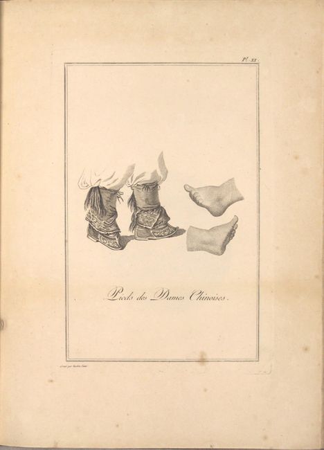
The 38 beautiful engravings illustrate numerous aspects of Chinese life and culture, including natural curiosities, plants, fishing, farming techniques, the Great Wall, a theater, and traditional costumes. A fascinating record of China in the late 18th century. Title page, list of plates, 38 plates, 3 folding maps. Hardbound in period binding with quarter leather over paper-covered boards, with gilt tooling and a red leather title label on spine.
References:
Condition: B+
The maps have very light offsetting and soiling, minor misfolds, and short binding tears. The plates have minor soiling, and some plates are missing the tissue guards, which were apparently not bound into the volume. The hinges are starting and the covers and spine show light wear with bumped corners, a few small abrasions, and light soiling.