Subject: Africa
Period: 1650 (dated)
Publication: Cartes Generales de Toutes les Parties du Monde
Color: Hand Color
Size:
21.8 x 15.3 inches
55.4 x 38.9 cm
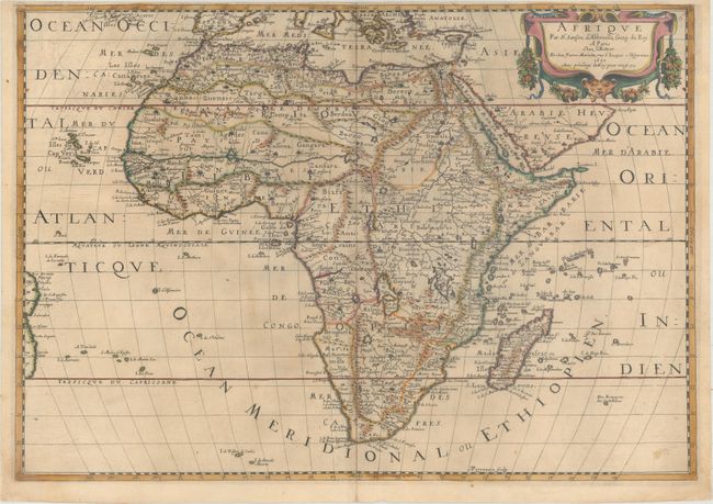
This is a handsome example of Nicolas Sanson's style. Though not as ornate as his Dutch competitors, Sanson was esteemed for his geographic clarity and delicacy of engraving. This is one of several maps of the continent prepared by the important French cartographer. Part of a series of maps showing the ancient world, it depicts Africa as it was understood prior to European exploration of the continent in the sixteenth century. Although the outline of the continent is more up-to-date, the geography of the interior is based on Ptolemy and other ancient sources. The map is filled with spurious details including the twin lake sources of the Nile and peculiar mountain ranges. It includes the Canary and Cape Verde Islands as well as several other Atlantic islands and the coastline of Brazil. Madagascar and many islands in the Indian Ocean also appear. Features a strapwork and garland style title cartouche. Engraved by Abraham Peyrouin, one of the many fine engravers employed by Sanson.
References: Betz #78; Pastoureau, SANSON V A [13].
Condition: B+
Original outline color in the map with later color in the cartouche, on paper with a large coat of arms watermark. There is light toning, minor soiling, and a narrow top margin, apparently as issued.