Subject: Southeast Asia
Period: 1525 (published)
Publication: Claudii Ptolemaei Geographicae...
Color: Hand Color
Size:
16.9 x 10.9 inches
42.9 x 27.7 cm
Claudius Ptolemy was a mathematician, astronomer and geographer who worked in Alexandria, then a part of the Roman Empire, in the 2nd century AD. One of the most learned and influential men of his time, his theories dominated both astronomy and geography for nearly 1500 years. His writings were kept alive by Arabic scholars during the Middle Ages and reemerged in Europe during the Renaissance. The birth of printing led to wide dissemination of his great works on astronomy and geography. There were a number of editions of his Geographia beginning in 1477. These early editions contained maps based on his original writings, known as Ptolemaic maps. As geographic knowledge increased with the explorations of Columbus, Magellan, Cabot and others, maps of the New World were added, and maps of the Old World were revised. Ptolemy's Geographia continued to be revised and published by some of the most important cartographers including Martin Waldseemuller, Sebastian Munster, Giacomo Gastaldi, Jodocus Hondius, and Gerard Mercator (whose last edition was published in 1730).
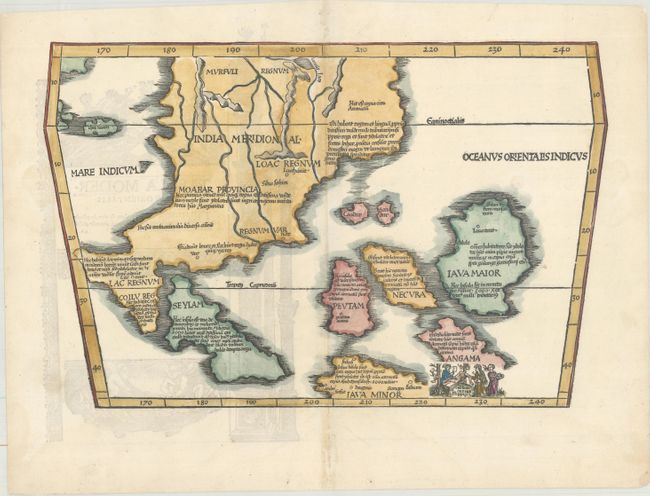
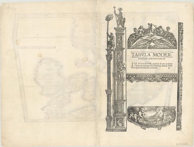
This scarce map is a landmark in the cartography of Southeast Asia - the first printed map to focus on the region of Malaya, Indochina and the East Indies. It was based on Waldseemuller's large 1507 cordiform world map, which was in turn taken from the Martellus model with nomenclature derived principally from Marco Polo. The mythical Lake Chiang Mai, labeled Lamia Lacq, is located at the top border. The islands are placed in a barely recognizable fashion including Iava Maior in roughly the position of Borneo. The map's nomenclature is derived principally from Marco Polo. A small vignette illustrating cannibalism is set in the island of Angama (Andaman Islands), which is totally misplaced to the east of Java. A lovely additional woodcut engraving is on verso. This map was one of three new maps that Fries had engraved for his editions of Ptoelmy's Geographia that were not reduced versions of Waldseemuller's maps. This map first appeared in the 1522 edition of Fries' Claudii Ptolemaei Geographicae....
References: Mickwitz & Miekkavaara #208-42; Suarez (Sea) Fig 62, pp.114-118.
Condition: B+
A bright example on paper with a small anchor medallion watermark. There are professional repairs to a few minor holes and separations along the centerfold, minor toning along the centerfold, and some show-through of engraving on verso.