Subject: North America
Period: 1790 (circa)
Publication: A New and Easy Introduction to Universal Geography
Color: Hand Color
Size:
2.8 x 4.1 inches
7.1 x 10.4 cm
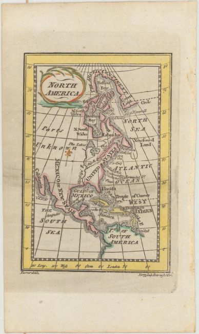
This charming miniature map was created by Reverend Richard Turner and published in his duodecimo geographical textbook in a number of editions in London between 1780-1819. This simple map shows the United States confined east of the Mississippi River, with the entire west labeled Mexico or New Spain. The northwest is indicated as "Parts Unknown." The Great Lakes are given a very rudimentary shape, with Lake Michigan and Lake Huron appearing as one larger lake with islands. Canada and Greenland are connected by the "Arctic Continent." Drawn by Turner and engraved by Garnet Terry.
References: King (2nd Ed.) p. 183.
Condition: A
Light printer's ink residue near the middle of the map and remnants of hinge tape on verso.