Subject: China, Korea & Japan
Period: 1628 (published)
Publication: Atlas Minor
Color: Black & White
Size:
7.6 x 5.3 inches
19.3 x 13.5 cm
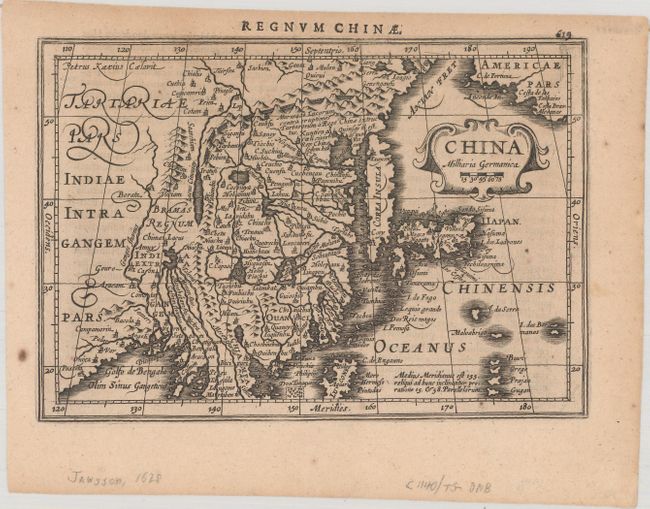
This handsome map of the region is based on the folio map by Jodocus Hondius and was designed for the Atlas Minor, first published in 1628. The eastern part of China (bounded in the west by the Great Wall) is dominated by several large lakes and major rivers. Korea is depicted as a strangely shaped island. The three main islands of Japan are shown below the strapwork cartouche. Americae Pars appears in the upper right corner separated from Asia by a narrow Anian Strait. Engraved by Petrus Kaerius. Latin text on verso, published in the first edition of the Atlas Minor.
References: Van der Krogt (Vol. III) #8410:352.1.
Condition: A
A crisp impression with a few spots of foxing primarily confined to the blank margins and one tiny worm hole in the image, only visible when held to light.