Subject: Central China
Period: 1700 (circa)
Publication:
Color: Hand Color
Size:
20.3 x 18.1 inches
51.6 x 46 cm
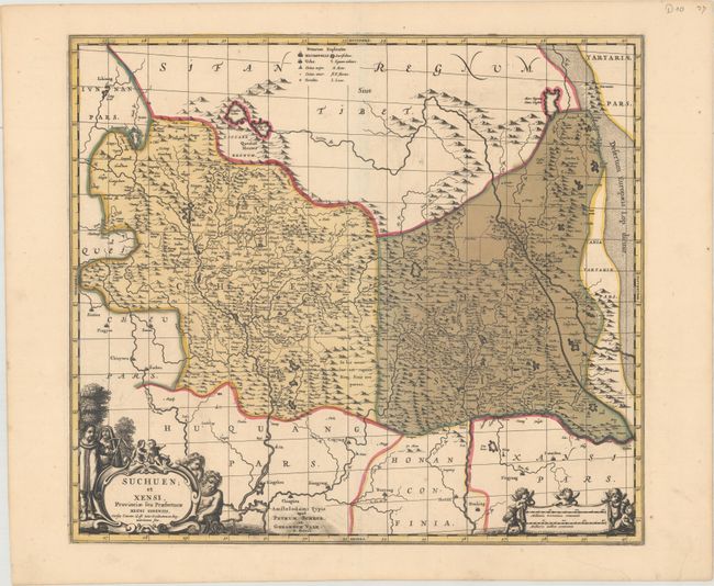
This superb map of central China is based upon the work of Jesuit Father Martino Martini who traveled through the region between 1643 and 1650. His work greatly advanced European knowledge of the region including the astronomical positions of many cities and topographical features. The map shows the provinces of Sichuan and Shaanxi with major towns and cities identified by tiny buildings including Chengdu (Chingtu) and Xi'an (Sigan), which was a starting point for the Silk Road. North is oriented to the right, with the Great Wall and Gobi Desert prominently depicted along the right side of the map. The title cartouche is flanked by a Chinese and Jesuit man and the scale of miles cartouche is surrounded by putti. Originally issued by Jan Jansson, this is the later re-issue by Gerard Valk and Peter Schenk.
References:
Condition: A
A dark impression with full original color and printer's ink residue in the publisher's imprint at bottom center. There is a short tear in the bottom blank margin that has been repaired with old paper on verso.