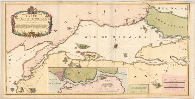
Subject: Northwestern Turkey, Istanbul
Period: 1784 (dated)
Publication:
Color: Hand Color
Size:
41.3 x 20.8 inches
104.9 x 52.8 cm
This large-scale map depicts the strategic waterway between the Aegean and the Black Sea and between Europe and Asia. It is based upon the work of Franz Kauffer and prepared for Comte de Choiseul-Gouffier, who was the French Ambassador to the Ottoman Empire beginning in 1784. The chart was beautifully engraved by Perrier and includes a detailed inset of the Bosphorus Strait showing numerous soundings, current directions, and shoals. Adorned by a decorative title cartouche, compass rose with radiating rhumb lines, and 5 distance scales at lower right.
References:
Condition: B+
Issued folding on watermarked paper. There is light scattered foxing primarily along the top and bottom border, and a minor fold separation confined to the bottom blank margin that has been archivally repaired on verso. The left side margin has been slightly extended with old paper.