Catalog Archive
Auction 165, Lot 576

"Nouvelle Carte de l'Etat Present de l'Italie, pour Parvenir par une Methode Nouvelle, a la Connoissance de la Geographie, et de l'Histoire; et Tres Utile pour les Voiages", Chatelain, Henry Abraham
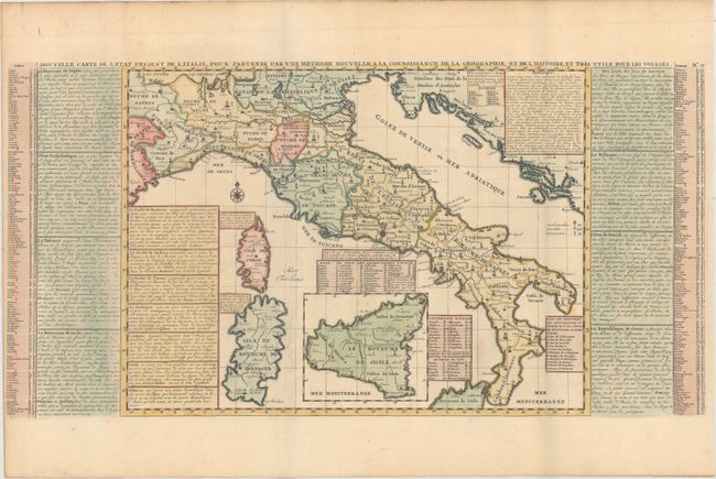
Subject: Italy

Period: 1708 (published)

Publication: Atlas Historique…

Color: Hand Color

Size:
25.7 x 13.1 inches
65.3 x 33.3 cm
Download High Resolution Image
(or just click on image to launch the Zoom viewer)

This detailed map of Italy is divided into political boundaries and includes Corsica, Sardinia, and Sicily. Tables surrounding the map list the locations of key cities, archibishoprics, universities, and cities affected by the 1703 earthquake. Blocks of French text describe the various regions in Italy. Printed on two joined sheets.

References:

Condition: A

A crisp impression, issued folding with a hint of offsetting and light toning along the edges of the sheet. Narrow side margins, as issued.

Estimate: $240 - $300

Unsold

Closed on 11/15/2017

Archived