Subject: Western Hemisphere - America
Period: 1794 (dated)
Publication:
Color: Hand Color
Size:
21.3 x 19.6 inches
54.1 x 49.8 cm
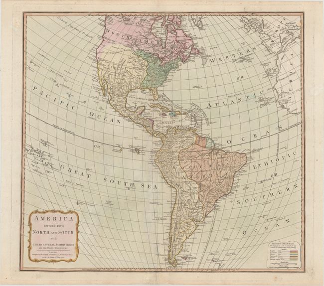
This map of the Americas shows the United States confined to east of the Mississippi River with Florida and much of the rest of the country shown under Spanish control. A colored key identifies the colonial possessions of the English, Spanish, French, Portuguese, and Dutch. The area of Texas is labeled New Mexico and both Taos and Sante Fe are located. The Northwest is largely blank but two different possible River of the West locations are shown. In South America, there is good inland detail of the river system but two fictitious lakes, Parime and Xarayos, are identified.
References:
Condition: B+
Full original color on paper with a large coat of arms watermark, a few small spots, and professionally repaired centerfold separations at top and bottom.