Catalog Archive
Auction 165, Lot 496

"Regnorum Hispaniae et Portugalliae Tabula Generalis jam nuper edita, nunc denuo revisa, aucta e ad Usum Scholarum", Homann, Johann Baptist

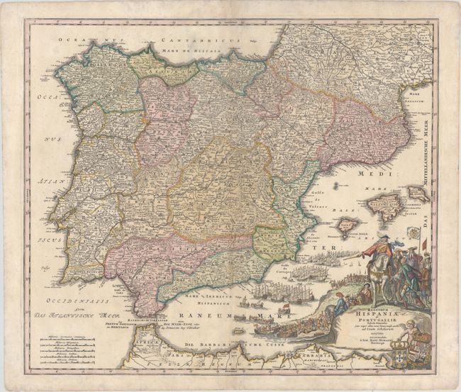
Subject: Spain & Portugal

Period: 1725 (circa)

Publication: Atlas Novus Terrarum…

Color: Hand Color

Size:
22.3 x 19.1 inches
56.6 x 48.5 cm
Download High Resolution Image
(or just click on image to launch the Zoom viewer)

This terrific, large map of the Iberian peninsula includes the Balearic Islands and part of the northern coast of Africa. This is Homann's first, and most visually impressive map of Spain and Portugal. It is filled with his typical level of detail, which includes early roads, and is adorned with a marvelous pictorial cartouche. The scene shows the launching of the massive Spanish Armada. A cherub at bottom displays the royal arms for Spain and Portugal.

References: Shirley (BL Atlases) T.HOM-1b #6.

Condition: B+

Original color in the map with later color in the cartouche and light soiling. The centerfold has been archivally reinforced on verso, and there is an extraneous crease adjacent to the centerfold.

Estimate: $350 - $425

Sold for: $400

Closed on 11/15/2017

Archived