Subject: Southwestern France
Period: 1716 (circa)
Publication: Grosser Atlas
Color: Hand Color
Size:
22.5 x 18.9 inches
57.2 x 48 cm
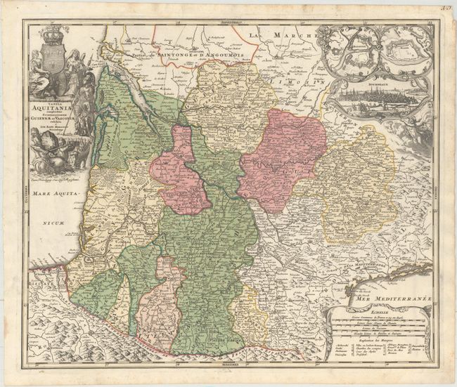
This is a large and decorative map of southwestern France, fully engraved with mountains, forests, roads and cities. Decorative borders surround the three insets: fortification plans of Bayonne and Blaye, and a fine vignette bird's-eye view of the city of Bordeaux. The map carries good detail of the Pyrenees and a highly detailed depiction of the Canal du Midi, here labeled the Canal Royal. This fantastic undertaking connected the Atlantic (via the Garonne River) with the Mediterranean in one of the most incredible engineering feats of the 17th century. It was opened in 1681 after fourteen years of construction under the direction of Pierre Paul Riquet. The map is further embellished with a large, allegorical title cartouche.
References:
Condition: A
Full original color with light, marginal soiling and a short tear in the top blank margin.