Catalog Archive
Auction 165, Lot 452

"Carte de la Laponie Suedoise", Chatelain, Henry Abraham

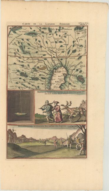
Subject: Northern Sweden & Finland

Period: 1720 (circa)

Publication: Atlas Historique

Color: Hand Color

Size:
8.1 x 13.4 inches
20.6 x 34 cm
Download High Resolution Image
(or just click on image to launch the Zoom viewer)

This sheet includes a map of Lapland, at the northern tip of the Gulf of Bothnia, including parts of northern Sweden and Finland. The bottom portion of the sheet includes three engravings related to the lifestyle and customs of the Lapps.

References:

Condition: A

A crisp impression on a clean sheet with minor toning along the edges of the sheet.

Estimate: $140 - $170

Unsold

Closed on 11/15/2017

Archived