Subject: London, England
Period: 1705 (circa)
Publication:
Color: Hand Color
Size:
22.5 x 19.1 inches
57.2 x 48.5 cm
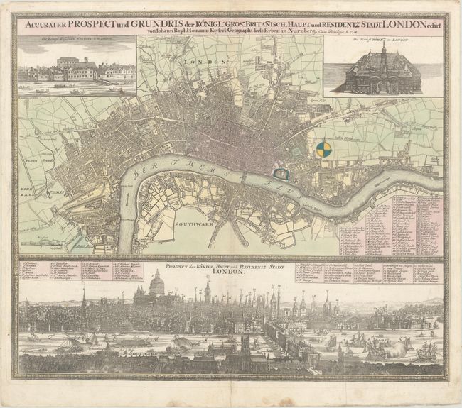
This highly detailed map of the vicinity of London covers the region from Islington south to Lambeth, and from Limehouse west to Marylebone. Decorative views of the Palace of Whitehall (which burned down in 1698) and the Royal Exchange fill the top corners of the map. Below the map image is a lovely view of the city with the Thames River bustling with activity near London Bridge. Both the map and view have extensive keyed tables to important locations, and each is surrounded by a decorative border. This is Homann's first plate of London according to Howgego.
References: Howgego #48.
Condition: B+
A nice impression on watermarked paper with a few faint spots, a few tiny fold separations, and one small puncture hole at the upper centerfold only visible when held to light. There is a printer's crease in the view at bottom right.