Subject: Europe
Period: 1669 (dated)
Publication: Mercurio Geografico...
Color: Hand Color
Size:
20.1 x 15.3 inches
51.1 x 38.9 cm
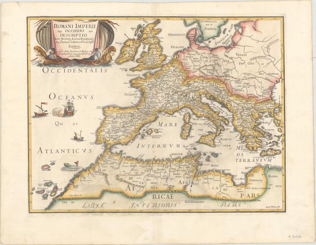
This finely engraved map of the Roman Empire was issued in the 1684 edition of Mercurio Geografico. Dated 1669, this map is one of the earliest to be included in the atlas, and includes Rossi's latinized name, Joan Jacobum de Rubeis, in the title cartouche. Cartographically, the map covers most of Europe and northern Africa and is embellished with ships and a sea monsther in the Atlantic Ocean. The title cartouche features two ships with figureheads prominently depicted. Engraved by Giorgio Widman whose imprint is visible in the bottom right corner of the map.
References: Shirley (BL Atlases) T.ROSS-1a #8.
Condition: A
A dark impression on a clean sheet of watermarked paper bearing a compass. There is light printer's ink residue.