Subject: Portobelo, Panama
Period: 1820 (dated)
Publication:
Color: Black & White
Size:
18.1 x 23.6 inches
46 x 59.9 cm
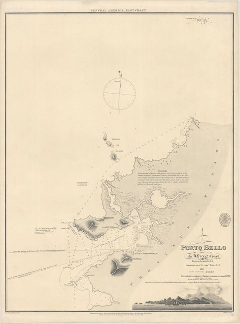
This British Admiralty Chart was first published in 1817 based on information gathered from a Spanish manuscript by Captain Taite. The chart shows the city and harbor of Porto Bello, as well as the surrounding coastline. The chart is filled with navigational notes, soundings, and rocks. The map extends north to include the Farallon Sucio islands. A land approach view, by Lieutenant Benjamin Baynton, shows the land from Cape Manzanillo to the entrance to Porto Bello harbor. After its initial publication, this chart received updates by Captain Hurd, Royal Navy Geographer to the Admiralty, in 1820. Advertisements for British Admiralty charts at the time indicated that "large amendments" were made to the chart as to require a new edition to be published. This updated edition was engraved by J. Walker and sold by J.D. Potter. The engraved seal of the Hydrographical Office, along with "price eighteen pence," appears above the title. This rare map is not listed in Captain Kit S. Kapp's cartobibliography of maps of Panama that was published by the Map Collectors' Circle.
References:
Condition: A
A clean and bright example with very minor marginal soiling and a couple of faint creases.