Subject: Western Texas
Period: 1878 (published)
Publication: H.R. Doc. 93, 45th Cong., 2nd Sess.
Color: Black & White
Size:
6 x 9 inches
15.2 x 22.9 cm
This 159 page report concerns the El Paso Salt War, which was an ownership struggle between Anglo-Texans and Mexican inhabitants over use of the local salt lakes to the northeast of the Rio Grande River. The once political struggle climaxed with the capture of 20 Texas Rangers by a force of 500 local Mexicans. American reinforcements, including the arrival of the African-American 9th Cavalry, would eventually overtake this small army, with many permanently fleeing south to Mexico. The end result was that this former community resource became privately owned via mineral right claims, thus cutting off access to the salt (a valuable commodity at the time). As a result of this bloody episode, Ft. Bliss was established as a permanent fort in 1878. The two maps included with the report are:
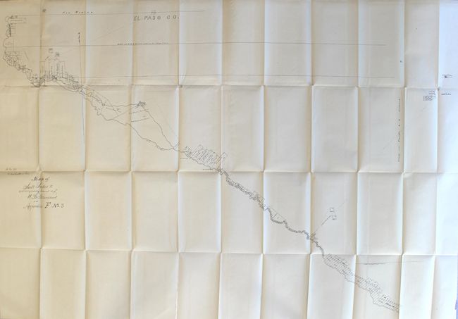
A. Map of Salt Lakes to Accompany Statement of W.B. Blanchard in Appendix F No. 3, bound in El Paso Troubles in Texas... (44.5 x 29.7"). Shows land ownership along the Rio Grande with a path leading to the Salt Lakes at top right.
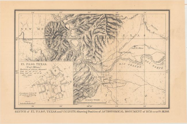
B. Sketch of El Paso, Texas, and Vicinity; Showing Position of Astronomical Monument of 1878 Near Ft. Bliss circa 1879 (10.9 x 7.0"). Depicts the region around Ft. Bliss including El Paso del Norte (Ciudad Juarez) and Old Fot. Bliss. Includes an inset of El Paso with individual streets named, and the location of the astronomical station.
References:
Condition: B+
The large folding map has a 4.75" binding tear and a 1.75" fold separation at left that have been repaired on verso with archival tape. There are also several tiny splits at fold intersections. Both maps and the disbound text have light toning.