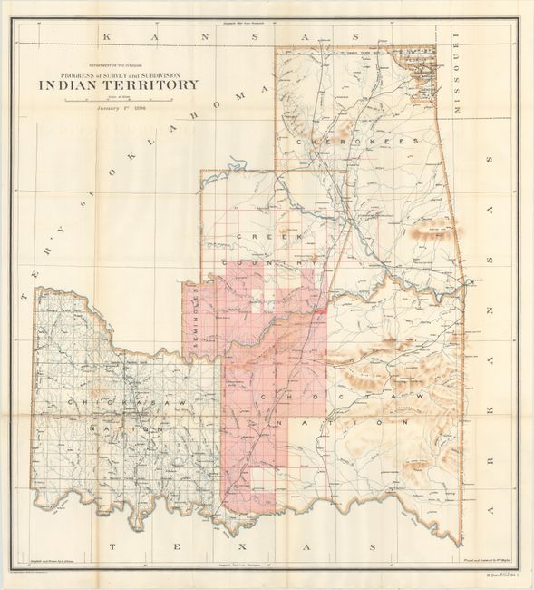
Subject: Oklahoma
Period: 1896 (published)
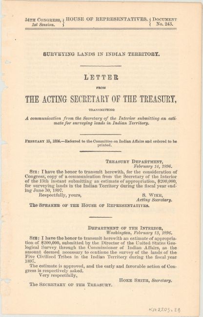
Publication: HR Doc. 243, 54th Cong., 1st Sess.
Color: Printed Color
Size:
26.7 x 28.7 inches
67.8 x 72.9 cm
This rarely seen map exactly matches the configuration of the State of Sequoyah the Indians attempted to create in 1905 in an effort to thwart the expansive tendencies of the United States. The regions of the Chickasaw, Choctaw, Creek, Seminole, Cherokee, and several other Indian tribes are named. The Territory of Oklahoma hovers ominously in the northwest. This historical map was compiled and drawn by R.P. Lowe, traced and lettered by Wm. Naylor. Lithography by the Norris Peters Company. The map is accompanied by the original four page report "Surveying Lands in Indian Territory, " dated February 15, 1896. A very nice example of this map.
References:
Condition: B+
Issued folding with a bit of light toning at the bottom of the left fold and faint offsetting of the title. There is a 2.5" edge tear at left that has been closed on verso with archival tape. Disbound text is very good.